Jump to:
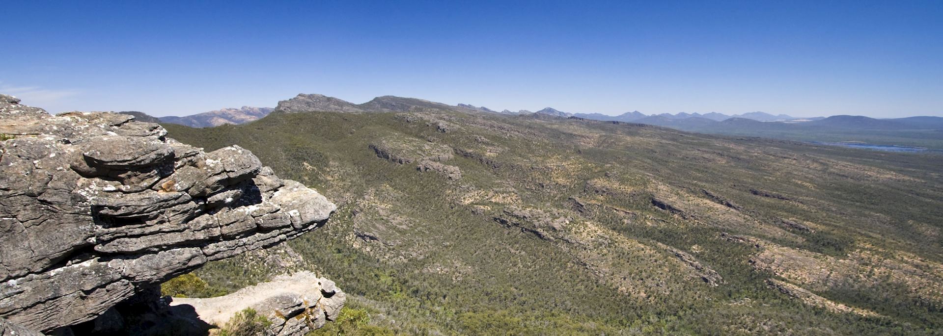
From the summit of Mount William, the soaring ranges of the Grampians seem to roll into the distance like an endless series of breaking waves.
Spanning close to two hundred thousand hectares the region is accessible by foot, car or canoe.
Exploring the Grampians National Park
Marked trails lead through plains of riotously coloured wildflowers to Aboriginal rock art sites or the magnificent MacKenzie Falls.
The Wonderland Loop Walk, although a little strenuous in places, takes you through the Silent Street Ravine to a string of rock formations and along a curving sandstone rock face called ‘The Elephant’s Hide’, with plenty of natural rock pools for a refreshing dip along the way.
Our favourite trail is to Mount Wudjub-Guyan where the massive sandstone outcrops and eucalypt-covered slopes offer uplifting views. There is also a beautiful and tranquil walk through tall forests to Silverband Falls. With its natural beauty and indigenous wildlife, the Grampians are simply outstanding.
who's been there

Start planning your tailor-made trip to the Grampians National Park by contacting one of our Australia specialists
-
01993 838 92501993 838 810
- Make an enquiry
Suggested itinerary featuring the Grampians National Park
This sample itinerary will give you an idea of what is possible when you travel in the Grampians National Park, and showcases routes we know work particularly well. Treat this as inspiration, because your trip will be created uniquely by one of our specialists.
Places near the Grampians National Park
- Port Fairy 78 miles away
- Daylesford & Macedon Ranges 99 miles away
- The Shipwreck Coast 108 miles away
- Apollo Bay 126 miles away
- The Great Ocean Road 127 miles away
- Victoria 137 miles away
- Robe 143 miles away
- Queenscliff 145 miles away
- Melbourne 150 miles away
- Mornington Peninsula 168 miles away
- Yarra Valley & Dandenong Ranges 169 miles away
- Phillip Island 180 miles away
- Coorong National Park 185 miles away
- Murray River 225 miles away
- Walhalla 230 miles away
- Wilsons Promontory National Park 247 miles away
- Fleurieu Peninsula 249 miles away
- Adelaide 265 miles away
- Barossa Valley 266 miles away
- The Gippsland Lakes 288 miles away
- Stanley 290 miles away
- Kangaroo Island 300 miles away
Photos of the Grampians National Park
Accommodation choices for the Grampians National Park
We've selected a range of accommodation options for when you visit the Grampians National Park. Our choices usually come recommended for their character, facilities and service or location. Our specialists always aim to suggest properties that match your preferences.
-
![Living area of mountain view cabin, DULC Holiday Cabins, The Grampians National Park]()
DULC Holiday Cabins
Grampians National Park -
![Villa, Meringa Springs, The Grampians National Park]()
Meringa Springs
Grampians National Park


